| |
CLIMBING EXPEDITION TO Mt. SAIFE (6161Mts) & Mt. THELU (6002Mts)
Hi everyone. Let
me introduce myself. I'm Ganesh working in HSBC, Bangalore as a
Banking Assistant. This article is a brief account of my first ever-climbing
expedition in The Greater Himalayan Range. And to be frank, adventure
sport was an oblivious subject till I actually completed my first
year in HSBC.
Within a year of
me joining HSBC, I came across this organization called Karnataka
Mountaineering Association (KMA), which has been a pioneering body
in the field of mountaineering and allied sports for more than 30years
now, in the state of Karnataka. As an active member, I had done
a lot of treks in the Western Ghats. My first ever Himalayan experience
was a trekking expedition to Khatling Glacier (3500mts) and upwards
to Maiali pass (15000feet), in the Uttaranchal region, sometime
in May- June 2002. That was the start of a dream to scale some of
the beautiful mountains. And who ever said dreams can only be dreams.
Think twice! Because had I not dreamt, I wouldn't have got this
chance to share with you all my experience of having successfully
summitted a 6000mts peak, for the first time.
It all started,
as usual, with the senior members of KMA planning a list of activities
for the year 2003. But since this year being the Golden Jubilee
celebration year of the first ever-recorded ascent of Mt. Everest
(29 May 1953) by Sir Edmund Hillary and Tensing Norgay, we thought
that the best way to show our solidarity and respect to such a great
event would be by organizing our own climbing expedition. After
going through some mountaineering journals, reference cum guide
books we decided to scale Mt. Saife on the Swetvarna Glacier, in
the Uttaranchal region. The planning began well in advance, nearly
two months before we embarked on the expedition. Immediately, a
list of members well qualified for expeditions was drawn. After
the initial selection (based on mountaineering courses, prior experience
on the mountains, level of fitness etc.), a team of four was chosen.
Prakash was chosen to be the expedition leader, Kiran Karkera, Krishnamurthy
and myself. The itinerary (for 25days), expected budget for the
expedition, list of team members with their profile was chalked
out and along with other relevant papers were sent to the Indian
Mountaineering Foundation (IMF), New Delhi to obtain permission.
Once the permission was received, we started checking and packing
our equipment (all provided by KMA) and the provisions that we might
require during our mountain days. The date of departure from Bangalore
was fixed for 14 August 2003
On 14th we boarded
the Karnataka Express to New Delhi, flagged off by the senior KMA
members. We reached New Delhi on the 16th and the same day set off
to New Tehri by the 8.30PM bus from the Maharana Pratap Inter State
Bus Terminus. We reached New Tehri at around 8.30AM on the 17th
morning. We immediately boarded the bus towards Uttarkashi. It is
115kms (approx. 4 to 5 hours) drive through some lovely landscape;
the only solace in an otherwise taxing journey. These are the mini
buses; extremely small, cramping you for leg space, over crowded
most of the times and to make matters worse, the commuters smoking
beedi continually. We reached Uttarkashi at around 1.30 PM the same
evening. Uttarkashi is a nice, small town but crowded with people,
mostly pahadis (hill people) who spend half a year working as porters
and the other half either to go to some other tourist spots to work
as porters or go back to their native villages. That evening after
freshening up and after having called up home to let everyone know
that we were safe and sound, we started the final round of preparations.
Porters were hired
from Highland Tours and travel and along with them went around the
town to buy the more bulky provisions (cereals to be specific) and
groceries. By evening we had packed everything and were ready. We
were to be accompanied by 9 Low Altitude Porters (LAPS) and 3 High
Altitude Porters (HAPs). On 18th morning we caught a bus towards
Gangotri, some 95kms from Uttarkashi, at an altitude of 3048mts
(10,000feet). After about 10kms of travel we abruptly came to a
stop. We were in the middle of a traffic jam, something that I thought
I wouldn't have to encounter for the next 25days. But this was a
traffic jam with a difference. It wasn't because of an accident
in the middle of the road, or because some minister was coming through,
but because of a landslide that had happened just an hour before
we reached the spot. Landslides are a common phenomenon in these
parts of the Himalayas and almost perpetual. And once you get stuck
you either turn back from where you started or walk across the slush
and loose soil to get to the other side, so that you find another
means of transportation. But for the time being, we thought against
both these alternatives, and just waited, the only reason being
for the fact that the GREF jawans were doing their best to clear
up the area and make the road accessible again. As hours passed
by, it became more evident to everyone waiting there, hoping that
the road would get back to a drivable condition that it wasn't going
to happen till the next day. After some discussion we decided to
cross the landslide area by foot and try getting a bus from the
other side it. Since buses don't ply after 2.00PM in these mountain
roads, we would have to wait till the next day, to catch one.
We trekked for
nearly 2kms in steady drizzle that had started by now, to a roadside
rest house in a place called Ganganani. The whole team spent the
night there. The next morning, couple of us went back to the landslide
area, to make enquires for any bus that would accommodate a team
of 16 members including our luggage and kit bag, into it, along
with other commuters. How glad we were to hear that we would have
to travel on top of the bus along with our luggage for the next
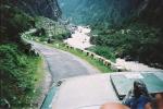
85kms! It's something that I shall cherish all my life. Just try
visualizing this! Sitting on the top of a bus right in the front,
on the left side holding the railing that's meant to support just
the luggage kept on the top, snaking roads with overhanging rocks
waiting to collapse any moment, rocks that come so close to you
that you have to duck down every time the bus pass through them
(fantastic exercise to your abdomen), deep valleys with the raging
Bhagirathi carving its way through the landscape, the fir trees
and the rugged looking snow capped peaks, and of course some hint
(wires crisscrossing above) that briefly reminded me of city life.
We reached Gangotri at around 4.30PM on the 19th. After a late lunch
at Hotel Gangaputra we walked around Gangotri that evening getting
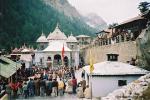
ourselves acclimatized to the altitude. Kiran and myself walked
up to the Gangotri temple and spent sometime enjoying a traditional
dance after some pooja that had taken place. Gangotri has
some interesting places one can go around visiting.
The GMVN complex,
the massive SuryaKund falls, Pandu Gupha to name a few. After breakfast
the next morning we started towards Gaumukh (14kms) from Gangotri.
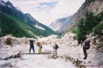
The trek route is fairly simple. There is a nice trekking path used
by both the trekkers as well as the pony back riders. Now that Gangotri
is a national park, trekkers or pony back riders have to pay specified
fees depending on the purpose of his/her visit to Gangotri and further
up. There is no need to utilize your provisions as the whole route
has well maintained dhabas, providing tired trekkers decent food
and a place to rest, if necessary, for a night at economical rates.
The route to Gaumukh takes you through 2 major stops one at Chirbasa
(8kms from Gangotri) and the second one at Bhojbasa (11kms from
Gangotri). Great weather means some superb scenery and we just had
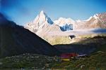
that. We halted that night at Bhojbasa. How close we were to some
of the most beautiful and some of the most talked about peaks in
the Indian Himalayas became evident only the next morning. The view
of Bhagirathi peaks (I, II & III), all towering over 6100mts, right
in front of us, some 10kms away from where we stayed, held us spell
bound. And this was just the beginning! We started towards Gaumukh
at around 8.00AM and were on the Gaumukh glacier by 11.00AM. From
here on began the real adventure. We had to cross over one part
of the glacier to get to the meadows, higher up. Scrambling up the
scree slope (loose rocks and gravel mixed with the glacier water)
that is at a gradient of nearly 70o, forcing us to crawl up on all
four. It took us an hour and a half to tackle this and get across
to the meadows. Once in the meadows it was another 5kms trek to
our base camp, which would be our home away from home, for the next
15 days. Finally on the 21st we reached the base camp, pitching
our tents at an altitude of 14800feet. I had bettered my earlier
record! The LAPS turned back to Uttarkashi from here after dumping
our luggage at Base Camp. Now we were just a team of 7 members,
4 from KMA and the 3 HAPs, BalBahadur (the senior most almost aged
55yrs), Hardev Singh and Bachan Singh (HAP cum cook).
That evening along
with the porters we unpacked all our equipment and the provisions,
and repacked them as per our mountain itinerary. 22nd morning would
be one of those days I would term as a perfect morning. The sun
rose from the horizon casting its rays all over the snow capped
mountains all around us. But the best of the lot was the golden
rays falling on Mt. Shivling (6543mts) that stood tall and magnificent
right behind our tent. Mt. Shivling is on the Gaumukh glacier. Magic,
absolutely magic! The sun was up and shinning on the clear blue
sky. After breakfast, as per our itinerary for that day we would
be ferrying some provisions and equipment to the Advanced Base Camp
(ABC @ 16500feet). And that would be our routine for the next three
days (23,24 & 25/08/03). Kiran and myself would be doing some load
ferrying with the HAPs Which basically meant that we would trek
up to the next highest campsite, boulder hopping and crossing some
glacier streams, to get up there and dump the provisions and equipment
and return back to the lower camp by evening the same day. Which,
as they say, is the best way to get acclimatized. It's very important
for anyone going to high altitudes, to get acclimatized if he/she
is planning to have a good time. The main reason being lack of sufficient
oxygen, as you get higher, which gives a splitting headache and
makes one feel very nauseate. He of she doesn't feel as hungry as
usual, which means insufficient intake of food. Tiredness and fatigue
sets in very fast. And, of course, the worst case would be to suffer
from HACE (High Altitude Cerebral Edema) or HAPE (High Altitude
Pulmonary Edema). Let me not get into the technical details of these
two dangerous effects, especially encountered by mountaineers, if
not properly acclimatized, which have caused so many deaths to mountaineers.
Our camp-1 was at an altitude of 18,500feet. We saw for the first
time the ridge of Mt.Saife, from up here.
Next morning, i.e.
on the 26th Prakash, Krishnamurthy and the 2 HAPs BalBahadur and
Hardev Singh set out on their summit attempt of Mt.Saife. But it
was bad news on the weather front! They started at around 7.00AM,
which is as such pretty late, if someone is trying a summit bid,
and now with lots of cloud funneling into the valley it meant poor
visibility and cold winds to bear with, while climbing. One of the
worst possible scenarios a mountaineer can be in! They were back
to the tent at around 3.00PM, only to give us the bad news that
they were short by 300feet from the summit. Deep crevasses, real
hard ice into which ice ax wouldn't go and lack of some equipment
had made their summit bid a failure. This only meant the worse possible
news for both Kiran and myself, our chance to summit Mt.Saife had
vanished. After lot of discussion and deliberation we decided to
get pack up and get back to our Base Camp. We were back at the base
camp by around 2.30PM on 27/08/03. As such feeling pretty low both
physically and mentally, both Kiran and myself had made up our mind
to get back to Gangotri the next itself instead of 30/08/03 as per
our itinerary. That evening, as usual, we sat down playing cards
listening to the transistor.
Through the course
of the game, just as we were discussing about mountains and related
subjects, the HAPs came to our tent and said that they could help
Kiran and myself still succeed in our first attempt to summit a
peak. It was decided than and there, that they would help us summit
Mt.Thelu (6002mts), right opposite Mt.Saife on the same glacier.
That night Bachan Singh with the help of other two HAPs sat down
making enough rotis to last us till the 29th morning. Come
28th, the four of us myself, Kiran, BalBahadur and Hardev Singh
set off towards the summit camp of Mt.Thelu. Midway through the
climb, we got caught in heavy drizzle and were forced to pitch our
tents much before we could reach the summit camp. This only meant
that the next morning we would have to trek for couple of hours
extra before we could actually start scaling the peak. But we enjoyed
every moment in the tent, making tea whenever we felt like, and
an early dinner too.
We decided to start
early on 29th, so that we could make use of a clear weather window
available early in the morning. We were out and on our way to the
base of Mt.Thelu the next day (29/08/03) by around 5.00AM finding
our way through the moraine and snow with the help of torch and
headlamps that we had carried. By around 6.00AM, as the first light
peeped through the clouds, we got a glimpse of our route ahead as
well as the path we had taken. The route ahead would be through
a huge snowfield. Here was the real problem. The snow, which was
initially hard and relatively easy to walk on, got softer and softer
as the day progressed. The heat from the sun started melting the
layer of soft, fresh snow making it tiresome and dangerous to trek
through. Tiresome because each step that we took, our foot would
go knee deep into the snow and dangerous because we didn't know
where there were crevasses and where there were loose boulders.
Some how we managed to get through all these and after about two
and a half hours of trekking we were finally at the base of Mt.Thelu.
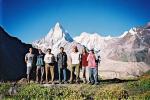
All around us stood
some of the most famous peaks of the Indian Himalayas, Sudarshan
Parbat (6507mts), Saife (6161mts) and lots of unnamed peaks. We
took a bit of a breather after the long trek and some time to photograph
all around. After about half an hour, we started our climb towards
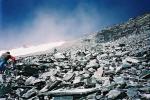
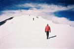
the summit of Thelu. Jeez, it was one tough climb. We were literally
crawling all the way up, through absolutely loose sliding slabs
of stones and gravel with no support and nothing to hold on to.
Every four to five steps we took, we slide down 2 steps. And with
the air getting thinner and thinner high up, we were gasping for
breath every 20steps that we took. Finally an hour and a half of
climbing (I mean crawling and scrambling), we reached the summit
shoulder. From here it would take us another 40 minutes to reach
the summit. We were already standing tall, at an altitude of 19700ft.
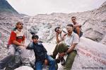
The summit is at an altitude of 19800ft. On 29/08/2003 at 10.30AM,
I had summitted Mt.Thelu (19800ft) followed by Kiran who did likewise
at 10.35AM. For a few minutes the two of us hadn't realized what
we had achieved that day, that moment. We were very tired and just
wanted to rest for sometime. Slow and steadily reality set into
us. We had scaled a peak that stood 6002mts (19800ft) above sea
level. Way, way higher than our previous best (14500ft)! And the
jubilation started. We were hugging each other in joy and ecstasy
and congratulating one another on a fabulous team effort that had
rewarded us with such a success. I was standing there, looking down
at the world below me. Staring at the horizon and into the blue
sky, with the clouds below our feet, I almost felt I was on top
of the world. There was the Sudarshan Parvat on to our left, Saife
along its ridge, Chirbas Parbat behind us, and the majestic and
magnificent Shivling, Meru Parbat, Thalay Sagar, the Jogin Group
of mountains (Jogin I, II and III) and many more unnamed peaks to
our right all sticking out of the clouds.
We spent nearly
15 to 20 minutes on the summit, taking photos of all the peaks around
us and of course of ourselves. A memory that shall last forever!
What made our summit success all the more special was the fact that
on the same date (29th) fifty years and two months ago (29/05/1953),
Sir Edmund Hillary and Tensing Norgay, at around 11.30AM had successfully
conquered the "TOP OF THE WORLD- Mt.Everest".
We started our descent
by 11.00AM and back to our base camp by around 2.00PM the same day.
We reached base camp by around 5.00PM. The LAPS had come there by
now, to porter all our luggage back to Gangotri. Everyone present
there congratulated the four of us on our grand success. We celebrated
it that night by having Kheer and some good food made by
Bachan Singh. We left the base camp on 31/08/2003 and were back
in the hubbub of civilization- Gangotri and down to Uttarkashi on
01/09/2003. We left towards Rishikesh on the 2nd enroute to Delhi.
With some time to spare before our bus to Delhi from Rishikesh,
we visited the famous Ram Jhula and Lakshman Jhula over River Ganga.
It's a six-hour backbreaking journey from Rishikesh to Delhi. Our
train to Bangalore was booked for the 5th of September. Which meant
2 days of sight seeing in Delhi. Thank God had it not been for couple
of my relatives staying there, it would have been really boring.
We were back in Bangalore on the 7th afternoon, greeted by some
the KMA members who had come to receive us at the station. The porters
had already conveyed the news of our success to them. Here is was,
back in Bangalore, which I along with 3 others had left some 25days
ago, dreaming and aspiring to be successful in our first ever summit
bid, getting congratulated for having successfully done so. And
it's only the beginning!
~ Ganesh K P
|
Photo Gallery
_summit_photox150.jpg)
|


_summit_photox150.jpg)